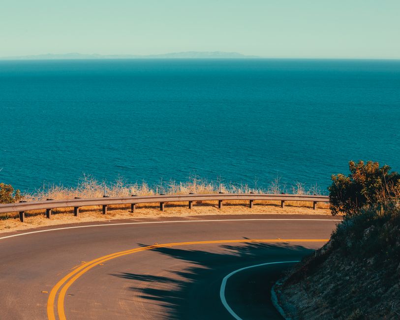
California’s Pacific Coast Highway (PCH) Road Trip: The Real Deal Guide
Ever just feel the need to hit the road? Windows down. Salty air whipping through. Yeah, that’s the California vibe. And if you’re chasing that feeling? Nothing beats the California Pacific Coast Highway. This isn’t just any road trip; it’s legendary. A journey where you’ll stop every five minutes. Another epic photo op. Forget the standard tourist traps. We’re talking the good stuff. The real chill spots you’ll remember long after the gas tank’s empty. Let’s dive in.
Best Spots to Hit Along the PCH, North to South
Starting up north, you’ve got Mendocino. Rugged beauty. Cliffs meet dense redwood forests. Head south and you hit iconic surf towns like Santa Cruz. Famous for its boardwalk. And killer waves. Monterey has a historic cannery row and a world-class aquarium. Neighboring Carmel? Pure storybook charm.
The Big Sur stretch? That’s the main event. Jaw-dropping vistas. The iconic Bixby Bridge. A real sense of wild, untamed beauty. Further south, you hit sun-drenched beaches. Celebrity homes in Malibu. Then the bustling energy of Santa Monica Pier. Keep going, and you’ll find laid-back Laguna Beach. And the vibrant city of San Diego. A perfect southern California finish. Each turn brings a new postcard view.
When’s the Best Time to Drive the PCH?
Timing? Super important for a truly stellar PCH trip. Many locals will tell you Spring (April-May) or Fall (September-October) are the sweet spots. Weather’s usually sunny but mild. Major summer crowds? They’ve either not arrived or have packed up. You miss that infamous “June Gloom.” Often blankets the coast in early summer.
But winter? Can be stunning. Dramatic skies. Fewer people. Just be prepared for rain. And potential road closures from mudslides in certain areas. And summer? Popular for a reason, schools are out, sun’s shining. But expect traffic. Higher prices. And good luck booking popular spots.
Quick Tips for Planning Your PCH Road Trip
Don’t just wing this trip. Not entirely, anyway. Book your place. Especially Big Sur or Carmel. Do it early. Like, months early. You’ve got options. Rustic campsites to boutique hotels. You’ll find everything. From killer roadside shacks serving fresh fish tacos. To fancy Michelin-starred restaurants.
Budget? Gas is gonna hurt. California fuel prices can be hella high. So, factor that in. Because eating out adds up fast. But grabbing groceries for picnics? Saves a ton. Most amazing views? Free. Just get outside!
Hidden Gems (Beyond the Obvious Stuff)
Yeah, Big Sur’s amazing. But there’s more to the PCH. North of Bodega Bay, check out Bodega Head. Incredible whale watching. And a quieter vibe. And another thing: the elephant seals at Año Nuevo State Park. Seriously, go see ’em. Especially when they’re pupping.
Don’t just stick to the main overlook turnouts. Take a few minute detours down coastal access roads. (If safe and permitted!) You might stumble on a secluded beach. Or a local-favorite viewpoint. That offers unparalleled privacy and peace. Sometimes the best views aren’t advertised.
Road Closures & Knowing Your Way Around
PCH’s stunning. But it’s on a wild, constantly shifting coastline. Mudslides. Rockfalls. Even wildfires. Can close sections of Highway 1. Rainy seasons especially. So, always, always check Caltrans. Before you head out. Their website and app give real-time updates. Total info on road conditions and closures. Don’t trust just GPS. It might send you down a closed road.
But if a section is closed? Your main alternative is often Highway 101. That runs further inland. It’s faster. But you’ll miss the stunning ocean views. Sometimes, small local roads can connect you around a minor closure. But research these carefully.
What to Do on The PCH (Besides Driving)
The PCH isn’t just driving. It’s a total playground. So many hiking trails. From easy strolls along bluffs. To challenging climbs through redwoods. Point Lobos State Natural Reserve near Carmel? Offers fantastic coastal walks. Julia Pfeiffer Burns State Park (McWay Falls, hello!) has gorgeous short trails.
And surfing? So California. Beginners can find surf schools and gentler waves. In places like Santa Cruz. Or various beaches in Orange County. Wildlife lovers? Whale watching tours are plentiful. Monterey Bay down to San Diego. Chances to spot gray whales, humpbacks, and even dolphins. Keep an eye out for sea otters, too – they’re hella cute.
So. The PCH? Not just a road. It’s a living, breathing testament to California’s wild beauty. Get out there and explore!
FAQs (Quick Hits)
Q: Many gas stations on scenic PCH stretches?
A: Nah, not many. Especially Big Sur. Fill up whenever you see one. Seriously.
Q: Best car for the PCH?
A: Any reliable car works. Something comfy, good with gas. But big vehicles? Totally fine too.
Q: Is it safe to pull over anywhere for photos?
A: Only designated spots. No shoulders! It’s super dangerous for everyone.